BLAIR HILL - Objection Deadline Closed
DEADLINE FOR OBJECTING:
The objection deadline has now officially closed, but the ECU may still accept late submissions. If you haven’t already, it’s worth submitting your objection using our automated system at https://blairhill.objectnow.co.uk
We’re incredibly grateful to all of you who have already objected—your support is invaluable. Now, we await Dumfries and Galloway Council’s decision and plan our next steps. This fight is far from over; together, we will continue to stand strong.
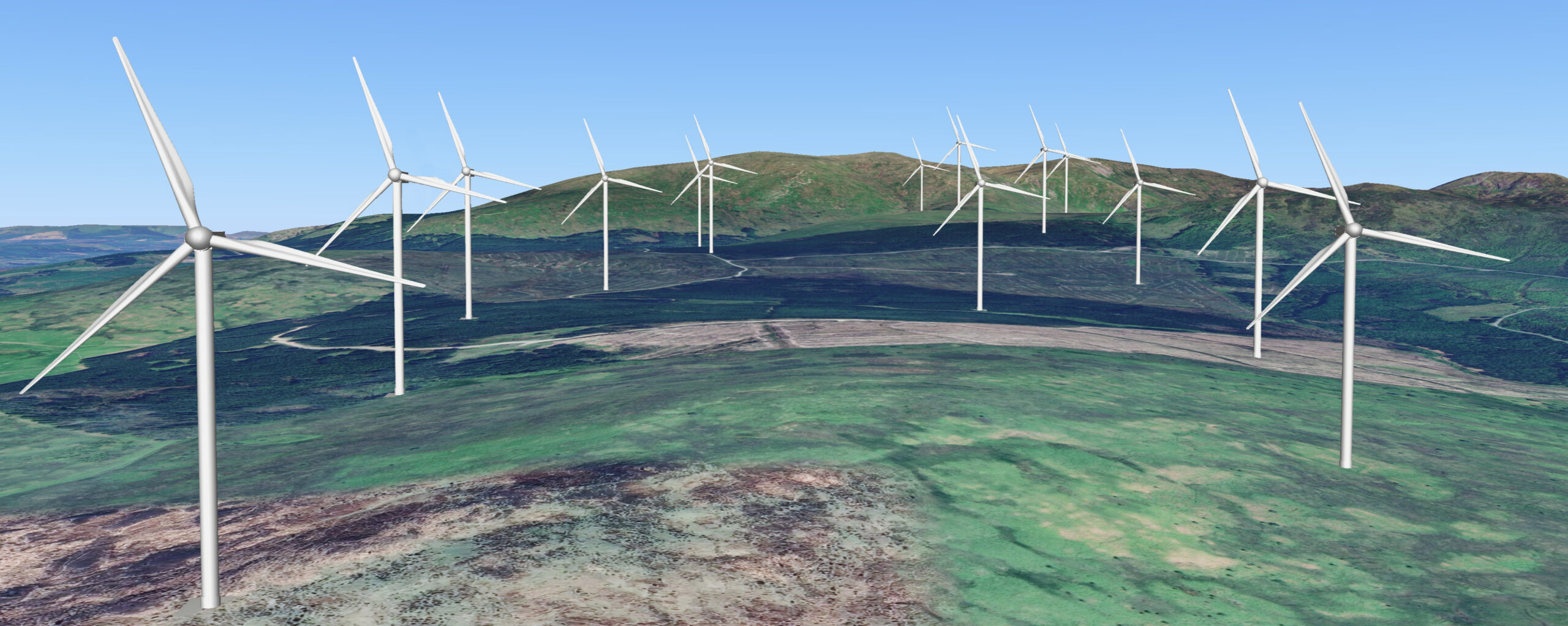
Proposed by Renewable Energy Systems (RES Group) Blair Hill Wind Farm, an Industrial Wind Turbine Site which would be located 2.5km North-East of Newton Stewart, with the centre of the site approximately located at: Easting and Northing (E) 241826, (N) 571717.
12 proposed turbines within the Blair Hill Wind Farm would be a gigantic 820 feet tall or 250 meters tall from base to blade tip whilst 2 proposed turbines at 689 feet tall or 210 meters all from base to blade tip, with all turbines being seen from over 35km away.
Proposed Development
And The Historical Landmarks Surrounding
Garlies Castle
Garlies Castle is a scheduled monument containing substantial remains of a late 15th/early 16th-century tower house, augmented with later additions. Positioned strategically above a steep south-east facing slope near Castle Burn, the monument, though currently surrounded by woodland, still commands elevated views over the landscape, notably towards the south. These views contribute significantly to its cultural importance.
The proposed development involves the installation of several industrial turbines (T20, T21, and T22) in close proximity to the monument. These industrial turbines are likely to be visible behind the monument, particularly when viewed from the south, potentially diminishing the prominence of the castle as a notable defensive feature in the landscape.
Consequently, the development poses a risk of substantial adverse impacts on the monument’s setting due to the vibrations from the industrial turbines that are in very close proximity and the introduction of conspicuously visible large-scale industrial turbines in key views, especially those of the tower.
Napper’s Cottage with a chambered cairn
The monument comprises a chambered cairn that belongs to a group known as the ‘Clyde Cairns’, dating back to the Neolithic period. The cairn which appears to be that of an elongated oval shape, and is approximently 25 meters by 15 meters, to a height of around 1.5 meters is mostly covered over by grass, and the exact shape and margins are difficult to ascertain, however with an array of loose stones and it’s height, this makes it clearly visible within the landscape.
The monument is of national importance as one of the most visible and best-preserved chambered cairns of Clyde type, and any disturbance to the land or surroundings could result in sealed materials of historical value from the Neolithic period being lost.
Dalvaird
The monument comprises a prehistoric burial cairn, visible as an upstanding mound, circa 0.9 m in height. The cairn measures approximately 14 m by 11 m in plan and is of sub-oval morphology.
Drannandow, Farmhouse
A Category B Listed Building, built in the early to mid-19th century. Constructed as a single storied farmhouse. The farmhouse is
constructed in squared and snecked whin masonry, with bull-faced granite margins and long and short quoins. The roof of the farmhouse comprises graded grey slates with an asymmetrical gabled attic.
The Thieves, Standing Stone
Two stones standing approximately 2 meters in height. The remains are possibly that of a stone circle, which is known as Blair Hill, which is the reason being the industrial wind turbine site being named the same. Again there is a mention of all these historical landmarks relating to lunar alignment.
Drumfern, Cairn and Stone Circle
The monument consists of a cairn and the remains of a stone circle. The cairn is 10 meters in diameter and 0.4 meters high, while the stone circle is 26 meters in diameter with several surviving stones standing to a height of around 1 meter.
Other landmarks
There are number of other heritage assets located within the landscape surrounding the proposed Blair Hill site:
• Boreland, Cairn
• Drumwhirn, Cairn
• Cordorcan, Cairn
• Machars Motte
• White Cairn
• Deil’s Dike
• Cairnsmore of Fleet
Newton Stewart
And Surrounding Towns & Villages
Increased Flood Risks
The disturbance or removal of a substantial expanse of peatland for the construction of turbine bases is anticipated to release sequestered carbon into the Earth’s atmosphere. Peatland, aside from its role in carbon capture, serves as a crucial defense against flooding. The displacement of peatland by the massive concrete foundations supporting the turbines poses a significant environmental concern.
Unlike peatland, concrete lacks the capacity to absorb water from inclement weather.
Consequently, precipitation from hillsides is expected to flow directly into the Penkilin Burn and River Cree. The Scottish Environment Protection Agency (SEPA) has issued warnings, stating that even a minimal increase in water levels in the Penkilin Burn and River Cree during intense rainfall events could lead to recurrent flooding in substantial portions of Old Minnigaff and Newton Stewart.
It is imperative to avoid artificially elevating these water levels by permitting the excavation of peatlands for the installation of unnecessary industrial machinery.
Economy
Newton Stewart and its surrounding region heavily depend on tourism throughout the year to maintain the financial viability of local businesses. Visitors are drawn to the untapped natural beauty of Newton Stewart, Glentrool, and neighbouring villages, engaging in activities such as hillwalking, cycling, and photography amidst the serene Galloway Hills.
The proposed installation of large industrial wind turbines, reaching a height of 250 meters, is expected to directly impact tourism in the area. Studies indicate a correlation between the presence of such turbines and a decline in tourism.
Community benefit funds offered by the RES Group are perceived by some as attempts to offset the impact of the turbines on the landscape and the associated financial repercussions for the community. The question arises as to why cash incentives are deemed necessary if these companies and the Scottish Government are confident in the environmental benefits of such initiatives?
Light Pollution
In adherence to regulations outlined by the UK Civil Aviation Authority, each turbine is obligated to feature a continuously illuminated aviation beacon positioned at its apex. These bright red lights are operational 24/7, ensuring compliance with aviation safety standards.
However, the persistent radiance of these lights presents a challenge to upholding Dark Sky Status in the surrounding area, contributing significantly to light pollution. This light pollution poses an impediment to the visibility of stars and the solar system during nighttime hours, impacting enthusiasts of astronomy in the vicinity.
The Gold Status currently held by Galloway Forest Park is at risk of being compromised due to the intense light emitted by these turbines during the night.
Saturation
Dumfries and Galloway currently accommodates more than 30 Industrial Wind Turbine Sites, featuring a cumulative total of over 590 turbines.
Our research suggests that Dumfries and Galloway has made a substantial contribution to green energy production, albeit acknowledging that the environmental impact of Industrial Wind Turbine Sites may not align seamlessly with their designation as “Green Energy.”
The saturation of such sites prompts a critical examination of the necessity for the inclusion of the Blair Hill Industrial Wind Turbine Site in the Scottish Government’s objectives for carbon emissions reduction. As of now, empirical evidence supporting the requirement for the Blair Hill site within the context of these goals remains unsubstantiated.
Futher Information
If you’d like more details about how the Blair Hill industrial wind turbine site might affect Newton Stewart or the surrounding villages, feel free to reach out to us. We’d be delighted to share a comprehensive list of information with you. Alternatively, you can check out our FAQ section, where you might find the additional information you’re looking for.
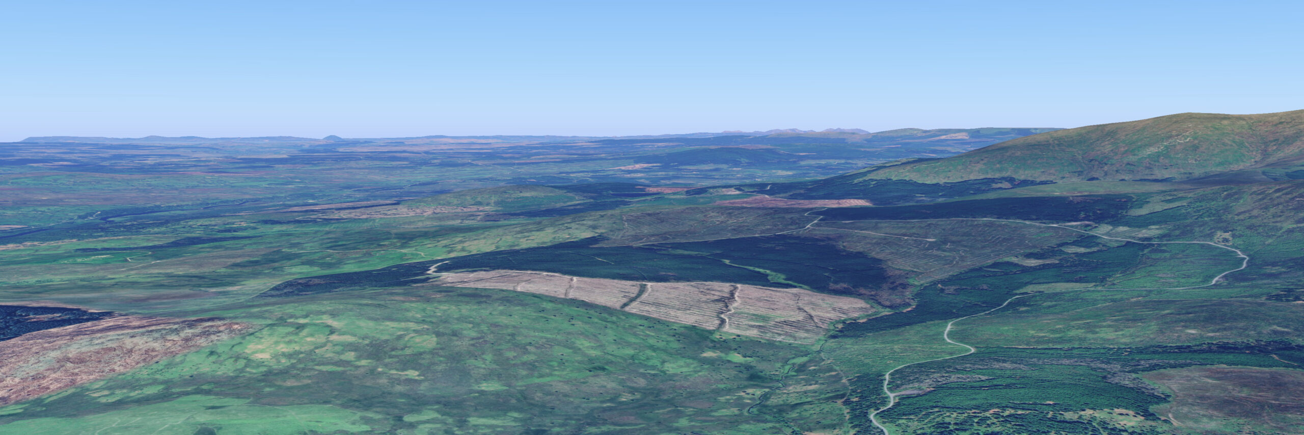
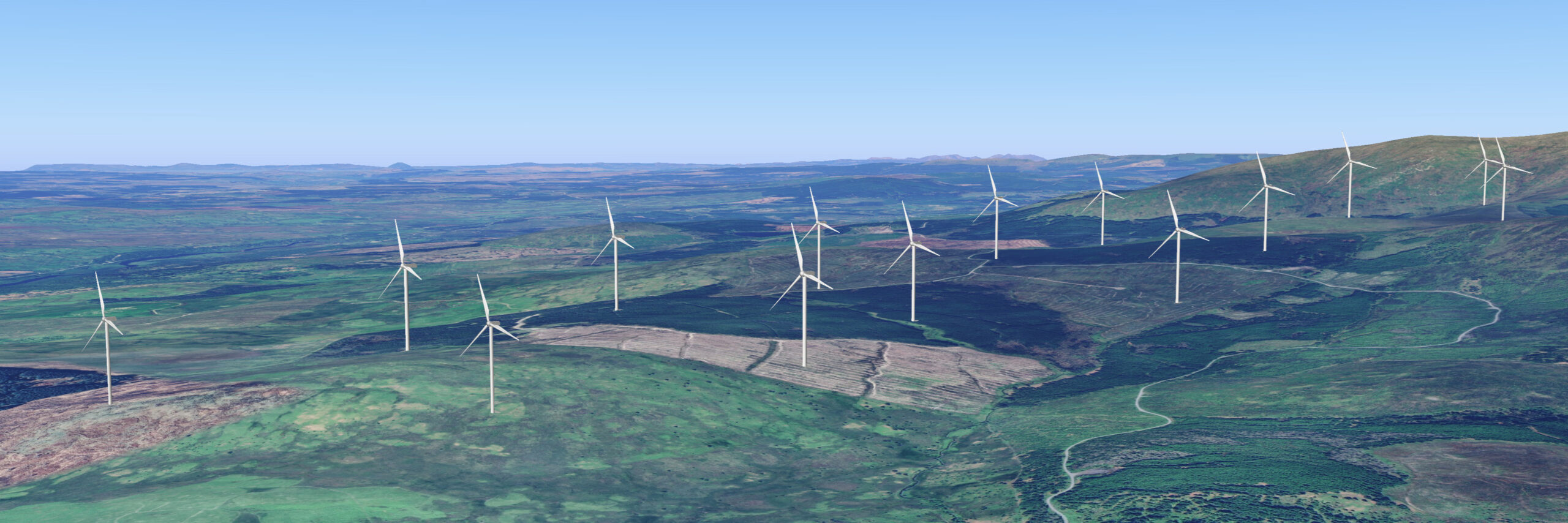
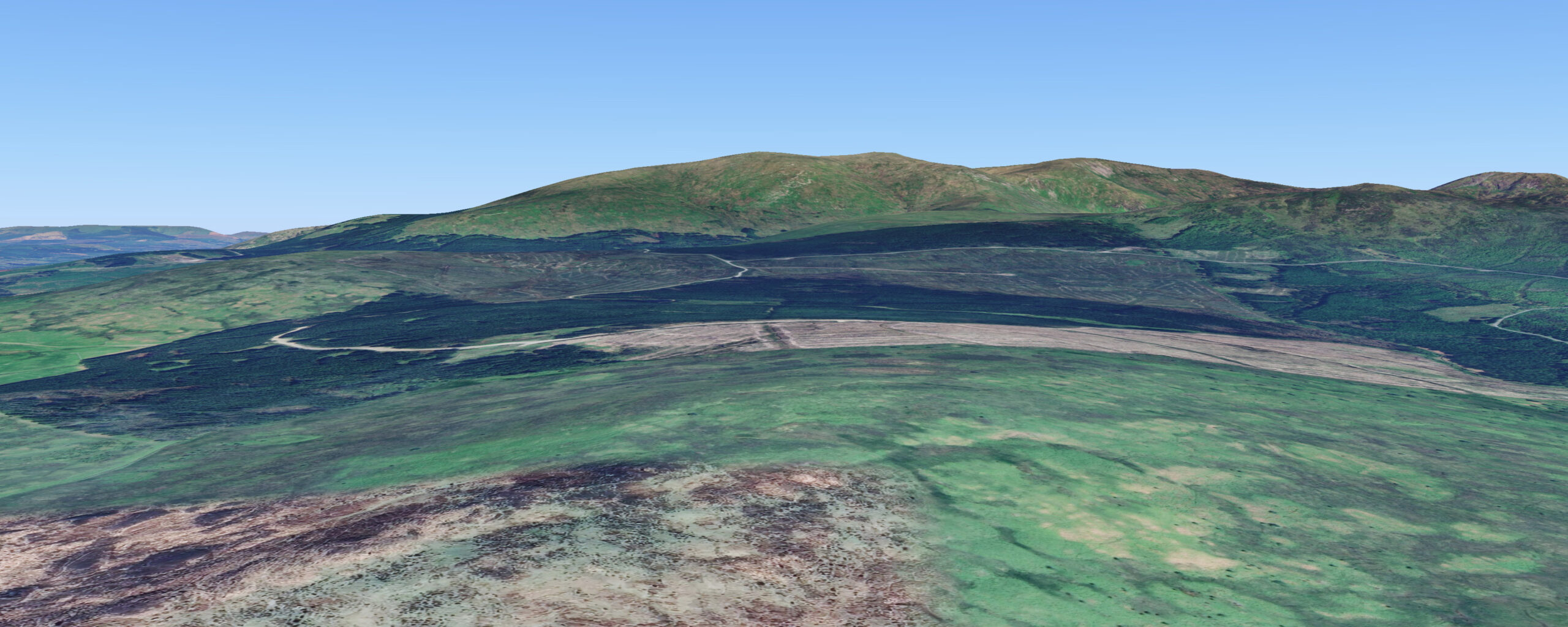
Before & After
Industrial Wind Site
Download Poster
Industrial Turbine Site